The City of Maple Ridge is advising residents who live in the Alouette River flood plain to be prepared for the coming storm season.
During last November’s atmospheric rivers, which brought the city an unprecedented amount of rain, the city put 800 residents living along the North and South Alouette Rivers on evacuation alert.
This month, the city is mailing information to residents living in these areas to to make sure they are prepared for possible flooding.
Last year, the rain volume resulted in landslides and flooding that closed major roads and bridges for the region.
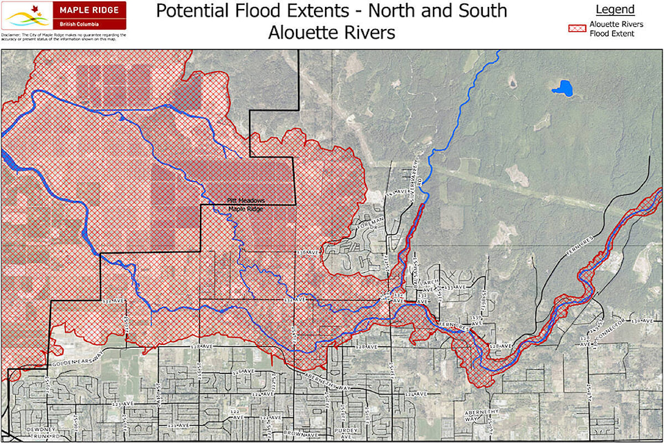
In Maple Ridge, the storm abated before water levels in the North and South Alouette rivers impacted access routes to the Silver Valley hamlets. While these two rivers have independent rainfall catchment areas, their downstream floodplains can interconnect during rainfall events. Both rivers are unconfined,without dikes, and flow rates are driven by local rainfall intensity. In some circumstances, BC Hydro can provide some reduction of flow for the South Alouette River, however this ability is dependent on rainfall intensity, available storage volume and the dam spillway capacity.
READ ALSO: Atmospheric rivers bring record rainfall and flooding
The city has studied these two watercourses over the years, resulting in the North and South Alouette Floodplain Analysis in 2016, and the completion of Integrated Stormwater Management Plans in 2021. Further information on these studies can be found on the city’s website at www.mapleridge.ca/2707.
The city uses an emergency preparedness guide which emphasizes being self sufficient for 72 hours. It is also available online.
In addition to the people whose homes are located in the floodplain, the information has also been sent to homes north of the river system in the Silver Valley Hamlets, because the access to their homes could be impacted by an extreme weather event. Citizens living in the flood risk area have been provided with a map that highlights properties that may be impacted by a severe weather event.
READ ALSO: Maple Ridge launches new emergency notification system
Residents are encouraged to sign up to receive alerts through the city’s emergency notification system (Voyent Alert!) which will be used during future extreme weather events. Rainfall and river level impact projections can change rapidly, so it is important to stay informed and engaged.
The app is free, easy to use and residents can register anonymously on the mobile app or online to receive email, text or phone to receive emergency alerts or critical incident notifications. Go to www.mapleridge.ca/453 to download the application.
Have a story tip? Email: ncorbett@mapleridgenews.com
Like us on Facebook and follow us on Twitter.