There is a winter storm watch for Metro Vancouver – including Maple Ridge and Pitt Meadows.
Environment Canada put up an alert at 11 a.m. on Tuesday, Jan. 4, warning that the region could receive between 10 to 20 cm of snow Wednesday night, Jan. 5, into Thursday, Jan. 6.
The government weather agency is warning of rapidly accumulating snow that could possibly affect Thursday morning’s commute, in addition to a risk of freezing rain.
“A low pressure system is forecast to approach the B.C. coast later Wednesday. Due to the recent cold temperatures, snow will develop Wednesday evening with snowfall accumulation ranging from 10 to 20 cm by midday Thursday,” warned the agency.
READ MORE: New record low temperatures hit Pitt Meadows
ALSO: Outdoor enthusiasts enjoy the snow in Maple Ridge
“Rapidly accumulating snow could make travel difficult over some locations. Travel is expected to be hazardous due to reduced visibility in some locations. Surfaces such as highways, roads, walkways and parking lots may become icy and slippery,” the alert continued, adding that there may be a significant impact on rush hour traffic in urban areas.
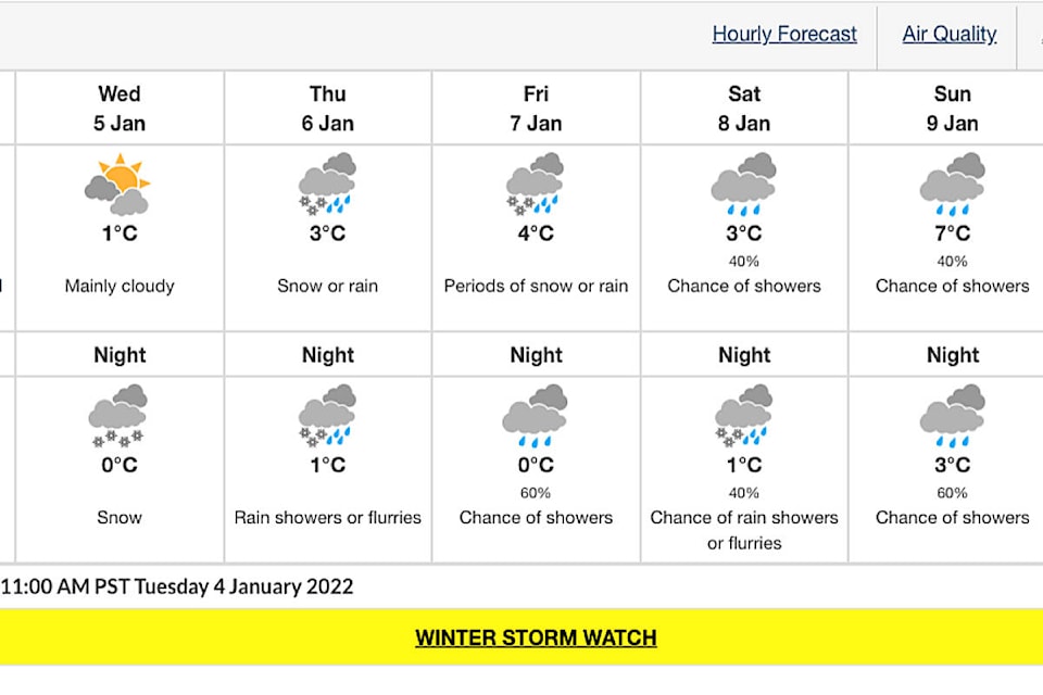
Wednesday is expected to be mainly cloudy with a high of 1 C. The temperature is expected to drop to 0 C over night and hit a high of 3 C on Thursday. Rain showers or flurries are being forecast overnight from Thursday into Friday when the high is expected to be 4 C with periods of snow or rain.
Have a story tip? Email: editor@mapleridgenews.com
Like us on Facebook and follow us on Twitter.