“I did not remember that Whonnock was so far away,” said my guest as he climbed out of his car.
He was delayed only a few minutes, driving comfortably along the four-lane Lougheed Highway and a few kilometers up 272nd Street, the former Whonnock Road, to where I live on 112th Avenue.
As I was closing our gate – a modest cattle gate, not one of these wrought-iron affairs that seem to be fashionable today – we started talking about the days before Lougheed Highway, when the ways of transportation in and out of Whonnock and Ruskin were at first only the river, and later the railroad.
In the mid-1890s, work started on two trunk roads through the municipality of Maple Ridge: River Road and Dewdney Trunk Road.
The work on River Road in Whonnock started in 1894 with the nomination of Benjamin Spilsbury as “path master” to oversee the building and maintenance of the stretch of River Road from Whonnock to Albion.
Benjamin’s priority and that of his neighbours was the extension and improvement of the road from their farms towards the east: to the Whonnock railway station, the store, the post office, and the church.
The westward stretch, from the Spilsbury farm to Albion was not important for the settlers.
That is evident from John Williamson’s diary from 1897.
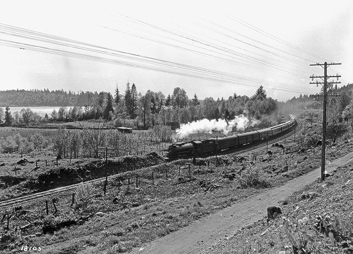
The diary tells about people hopping off and on trains, arriving and sailing on those wonderful paddle wheelers that brought people, freight and cattle everywhere.
People also rowed or were rowed to distant places, walked for miles, and some came and went on horseback, but there is not a word in the diary about the road to Albion.
What was of much greater interest for the settlers was the extension of River Road from Whonnock to the Stave River, crossing Whonnock Creek with a mighty wooden bridge that joined Whonnock and Ruskin.
Another high priority was the maintenance of Whonnock Road (272nd Street today) to the hinterland of “North Whonnock,” serving an increasing number of new settlers, some of whom were feared to associate with Webster’s Corners, now accessible via the Dewdney Trunk Road, rather than with Whonnock.
The lack of maintenance on the part of River Road between Spilsbury’s farm and Albion is evident from a 1908 letter to the editor of B.C. Saturday Sunset.
“On a recent trip,” the letter reads: “wishing to visit a couple of ranches some three miles east of Haney, and a mile out from the railway line, I enquired for a horse to drive out. I was advised to walk.
“The owners of horses did not care to have their animals driven over a part of highway east of the school of East Haney [Albion today]. I walked. Their care was justified.
“For a mile this road was a sea of mud, and if any of our brave animals of our horse show had been put through this road, their owners would not have recognized them, had they emerged alive and safe.”
River Road did not meet the standards for a highway for a long time. By 1929 came Lougheed Highway, which, together with Dewdney Trunk Road, makes it so easy to reach the eastern extremities of our municipality.
Still, in the minds of many who live in the urban parts of Maple Ridge, Whonnock and Ruskin remain faraway places.
– By Fred Brachers, a local historian who lives in Whonnock.