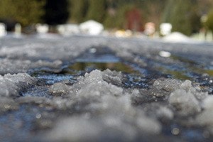
An Arctic outflow warning has been issued for B.C., including the Fraser Valley.
Strong outflow winds and cold wind chill values are expected or occurring this morning, Monday.
According to Environment Canada, an arctic ridge of high pressure over the B.C. interior will build southwards, giving arctic outflow conditions.
Wind chill values of minus 20 to minus 25 will persist over North Coast Inland sections through Tuesday. In Whistler, Howe Sound, and the Fraser Valley, wind chill values of near minus 20 can be expected tonight and Tuesday morning.
Strong northerly winds of 70 km/h gusting to 90 will persist through Howe Sound this morning, Environment Canada said.
"Any outdoor activity exposes you to an increased risk of frostbite. If outside, dress warmly in layers and stay dry. Cover as much exposed skin as possible to avoid frostbite. Be aware of the potential for falling branches or power lines."
Arctic outflow warnings are issued when bitterly cold air flows from the Interior to Coastal communities and the outflow winds create wind chill values of minus-20 or less for 6 hours or more.
• To report severe weather, send an email to http://www.weather.gc.ca/warnings/report_e.html?bc40=.itor tweet reports to #BCStorm.